
This framework relates to the extraction of a set of variables from VHRRS data. The main tasks are the following:
1. Data acquisition and pre-processing (2 SSA cities, products already available for Dakar and Ouagadougou). Pléiades tasking will be prepared (pansharpened and tri-stereo). The pansharpened images will be radiometrically corrected, orthorectified and mosaicked.
2. Generation of 3D products (2 SSA cities, products already available for Dakar and Ouagadougou)). 3D products will be generated from the tri-stereo imagery: DSM, DTM, nDSM, slopes…
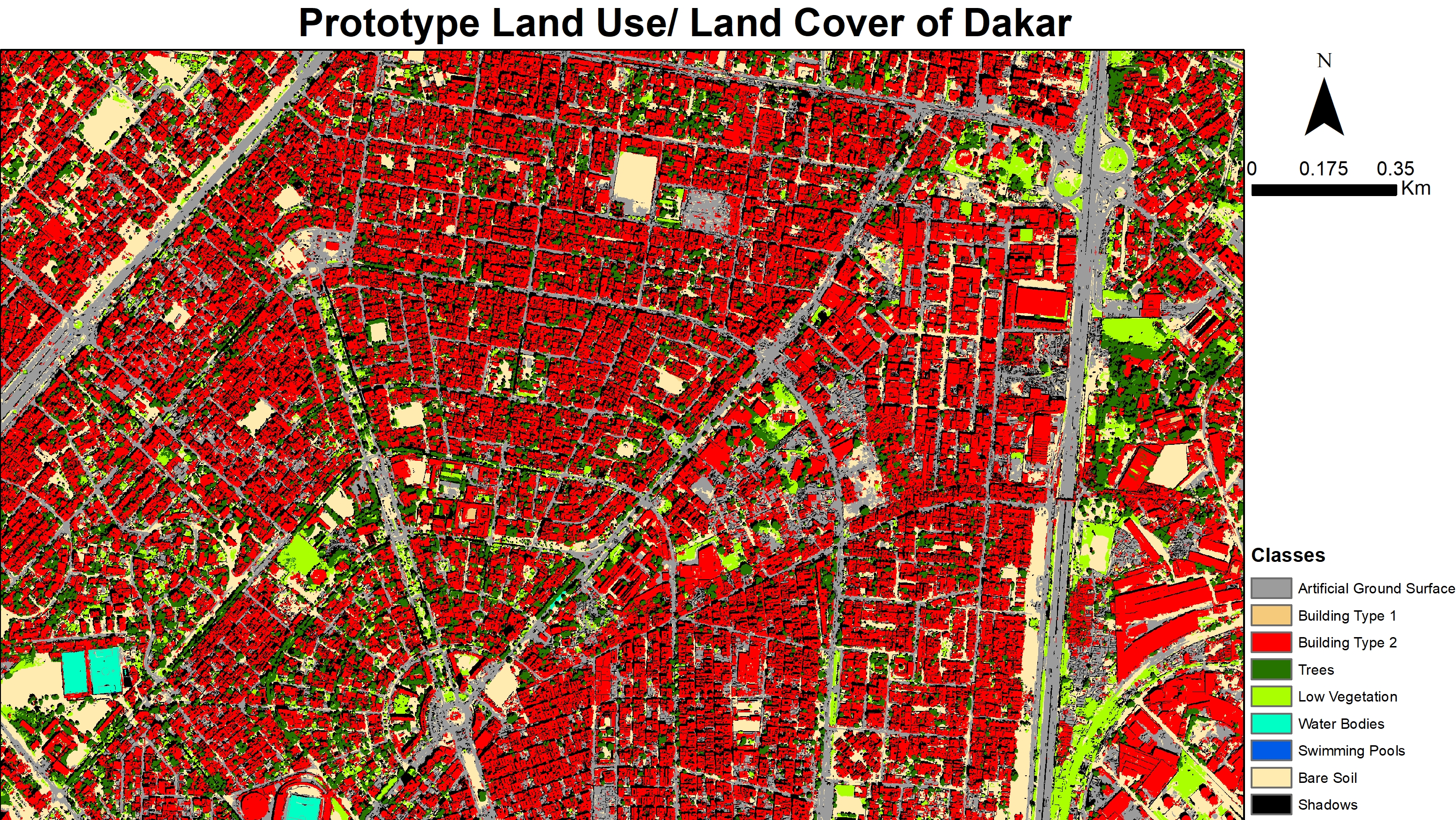
3. LU/LC classification (2 SSA cities, classifications already available for Dakar and Ouagadougou)). The methodology developed in MAUPP for optical imagery will be applied: The method is based on a fully open-source processing chain developed in GRASS GIS and R. Segmentation parameters will be selected based on intra-segment (variance) and inter-segment (spatial autocorrelation) metrics calculation. Next, several machine learning classification methods (such as support vector machine, Random Forest or Boosted regression trees) will be applied. Finally, classification results will be aggregated using a decision-level fusion strategy based on comparison of classification accuracy for each LU/LC class. The classifiers will be trained and validated using cross-validation.
4. Extraction of variables for the spatial models (4 SSA cities)
The open-source processing chain will be further developed to produce a wide set of variables in a 100m grid as input to the models. Here is a non-exhaustive list that will be refined during the project:For urban climate modelling: Radiative and thermal characteristics of the urban surfaces (roofs, streets, pavements), geometric characteristics (canyon height-to-width ratio, roof fraction, building height), soil cover (bare soil, urban agriculture, gardens, parks and semi-natural vegetation) will be derived as far as possible, taking into account the limitations of satellite imagery, particularly in challenging settings such as slums.
For demographic and socioeconomic modelling: average building size and height, spectral and texture indices, percentages of LU/LC classes, type and importance of road network, presence of built-up on/close to unsuitable areas (steep slopes, lowland flood plains, marshy areas, dumpsites…), distance to city centre (i.e. to employment opportunities), etc.
For epidemiological risk modelling: in addition to land cover classes and percentage of vegetation and built-up, distance to inland water, NDVI etc.