Mapping poverty in data scarce environments is a very challenging issue. Utilizing Earth Observation, we can attempt to shorten the gap, and get a reliable impression of spatial distribution of wealth in a city. For the first time, we made use of Demographic and Health Surveys (DHS) and very-high-resolution satellite data, to better understand household wealth in several African cities. We coupled machine learning algorithms, advanced spatial simulation methods, the wealth index extracted from the DHS along with a wide-suit of satellite-derived land-use and land-cover indicators to map household wealth at a city-wide level [1]. Taking as an example the city of Dakar, Senegal, our EO-based indicators could be semantically and interpretably linked to household wealth. Areas with higher proportions of swimming pools positively associated with household wealth while deprived areas where the most vulnerable population resides, were negatively linked to wealth (Figure 1).
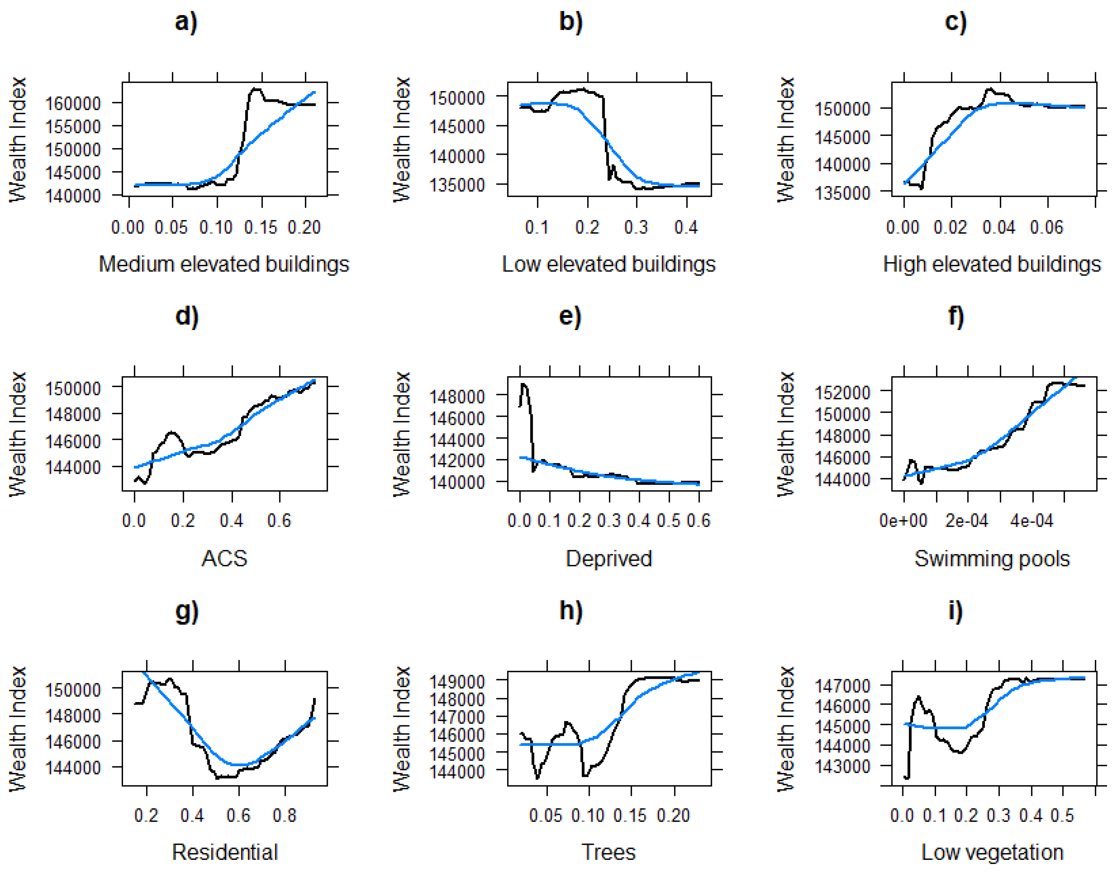
Figure 1. Partial associations between EO-derived indicators and household wealth in Dakar, Senegal derived from a Random Forest regressor.
Our machine learning models were used to predict household wealth an various administrative and raster scales. For instance, Figure 2 illustrates the predicted wealth at a neighborhood administrative level.
The validation of our models against census indicators demonstrated satisfactory correlations (correlation coefficient ranging from 0.40 - 0.60).
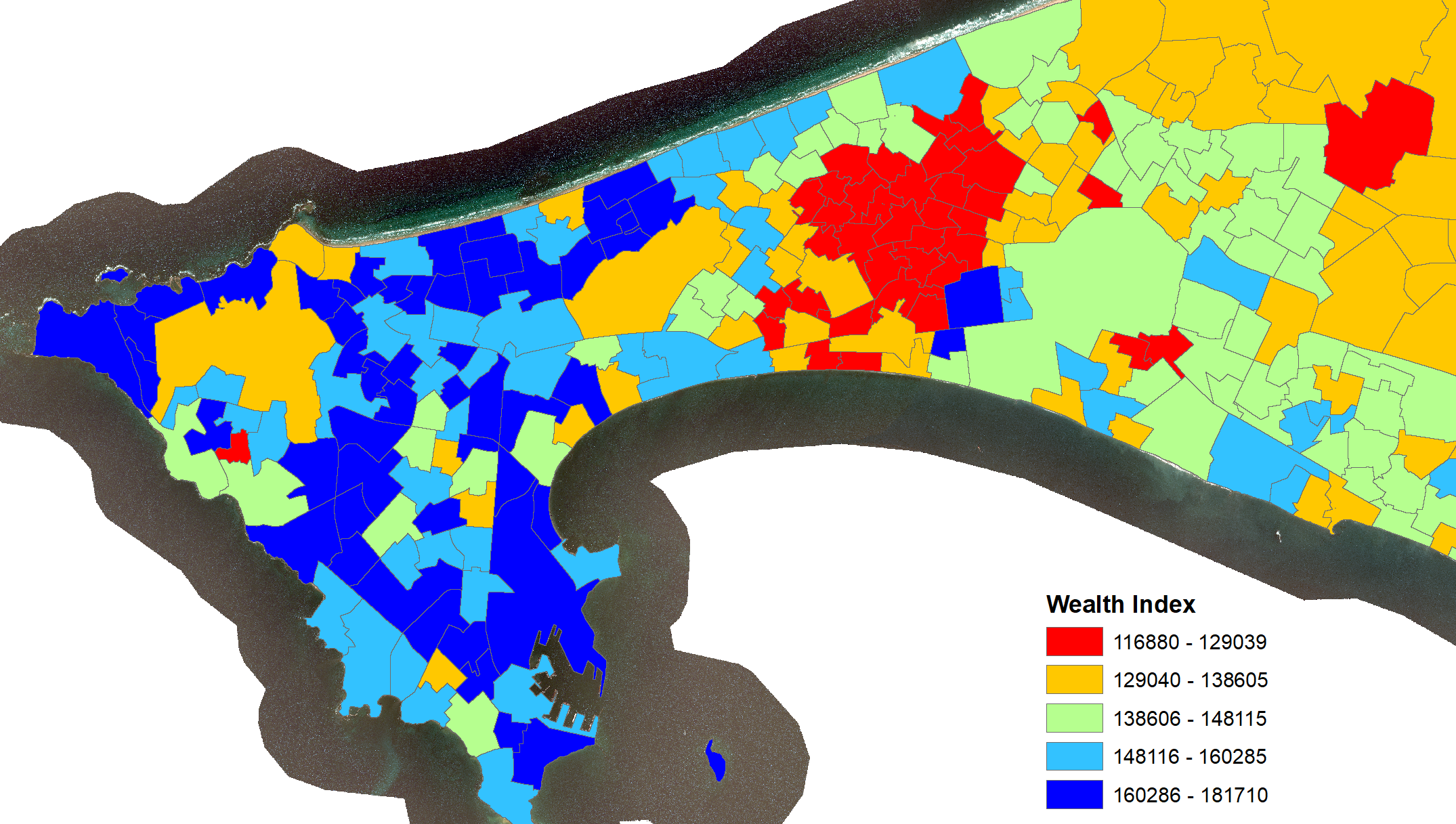
Figure 2. Predicted household wealth in Dakar, using machine learning and EO datasets.
References
[1] Georganos, Stefanos, et al. "Modelling the wealth index of demographic and health surveys within cities using very high-resolution remotely sensed information." Remote Sensing 11.21 (2019): 2543.